Address Count Listing Files Technical Documentation
Address Count Listing Files Technical Documentation
This page describes the file naming convention and record layout for the Address Count Listing Files. The Address Count Listing Files are updated biannually and include total housing units (including transitory units) and total group quarters counts by current census block. These files are created for all 50 States, the District of Columbia, Puerto Rico, and the Island Areas. The total housing units in the 2023 and 2024 files do not include transitory units.
2026
File Naming Convention for 2026 Address Count Listing Files
The Address Count Listing Files use the following naming convention: <st>_<name>_AddressBlockCountList_<mm><yyyy>.txt, where:
- <st> = Two-digit state Federal Information Processing Series (FIPS) code
- <name> = Concatenated state (or equivalent) name
- <mm> = Two-digit month the file was created
- <yyyy> = Four-digit year the file was created
An example file name is:
44_RhodeIsland_AddressBlockCountList_072026.txt
Record Layout for 2026 Address Count Listing Files
| Field Name | Field Description |
|---|---|
| STATE | Two-digit FIPS state code. This represents the current state. It may differ from the first two digits of the BLOCK_GEOID. |
| COUNTY | Three-digit FIPS county code. This represents the current county. It may differ from digits 3-5 of the BLOCK_GEOID. |
| TRACT | Current census tract number. Consists of six digits with the first four digits being the basic census tract number and the fifth and sixth digits after the decimal being the tract suffix. If the census tract is not suffixed the fifth and sixth digits are filled with zeroes. It may differ from digits 6-11 of the BLOCK_GEOID. |
| BLOCK | Four-digit census block number and one-character alpha suffix (where applicable). Census blocks are numbered uniquely from 0000 to 9999 within census tract, which nest within state and county. The first digit of the census block number identifies the block group. |
| BLOCK_GEOID | Concatenation of the 2020 Census state, county, and tract, and the current census block. The BLOCK_GEOID consists of up to 16 characters (when including block suffix) and is used in joining the block level feedback data to the blocks in the partnership shapefiles. |
| TOTAL_HOUSING_UNITS | Total number of addresses in the entity count list identified as housing units or transitory units by data in the Master Address File (MAF). |
| TOTAL_GROUP_QUARTERS | Total number of addresses in the entity count list identified as group quarters by data in the MAF. |
Related Information
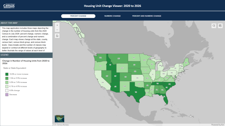
REFERENCE FILE
Address Count Listing Files and Related Map Viewers
THEMATIC MAP
Interactive Maps